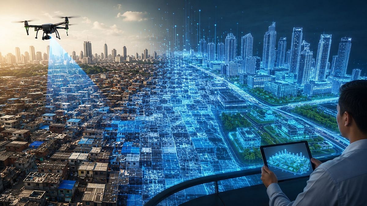
Dharavi, one of the world's most densely populated urban settlements, is at the center of one of India's most ambitious redevelopment projects. While the project continues to make headlines, a major technological development is now drawing attention for a different reason: the introduction of Digital Twin technology.
For the first time in India, a Digital Twin is being used at the scale of an entire urban redevelopment project, reflecting the government's focus on making Dharavi's transformation more transparent, data-driven, and future-ready.
What Is a Digital Twin?
A Digital Twin is an exact digital replica of a physical place or infrastructure. It creates a virtual model that mirrors real-world conditions in real time, allowing planners and authorities to analyze, monitor, and make informed decisions with greater accuracy.
Globally, Digital Twin technology is already used in some of the world's most advanced airports for operational planning, aircraft maintenance, and safety monitoring. It also powers smart city initiatives in Singapore, London, and several European cities, helping authorities manage urban infrastructure more efficiently.
Now, the same technology is being deployed for the Dharavi Redevelopment Project.
Mapping Dharavi Digitally
The entire 620-acre Dharavi area has been surveyed using drone mapping and LiDAR (Light Detection and Ranging) technology, creating an accurate lane-by-lane digital model of the settlement.
Key milestones include:
● 620 acres digitally surveyed.
● Around 1.25 lakh structures digitally mapped.
● Approximately 150 structures per lane documented on average.
● Every unit assigned a Unique Identity Number (UID).
● Each property digitally tagged with:
○ Unit size
○ Ownership details
○ Resident information
○ Supporting documents
○ Court or litigation records, where applicable
This comprehensive digital database serves as an exact replica of present-day Dharavi.
Why It Matters
The Digital Twin is expected to significantly improve transparency and efficiency throughout the redevelopment process.
Its primary applications include:
● Faster and more transparent resident verification.
● Digital authentication of ownership and supporting documents.
● Reduced scope for disputes during rehabilitation.
● Better planning of roads, utilities, and public infrastructure.
● Accurate preparation of Annexure-II, the final rehabilitation eligibility list.
According to project officials:
● Around 95,000 units have already undergone physical and digital surveys.
● Documents for nearly 85,000 units have been verified digitally.
A Data-Driven Redevelopment
Beyond documentation, the Digital Twin enables authorities to simulate infrastructure planning before construction begins. Roads, utility networks, public amenities, and transport corridors can all be designed using accurate, real-world data, reducing planning errors and improving execution.
Officials believe this technology will make the redevelopment process more organized, faster, and more efficient.
Looking Ahead
The Dharavi Redevelopment Project extends beyond housing. The broader vision includes:
● Modern residential and commercial developments.
● A multi-modal transport corridor through Dharavi.
● Future integration with the Mumbai-Ahmedabad Bullet Train network.
● Better connectivity with upcoming urban infrastructure.
The first 10,000 rehabilitation homes under the project are targeted for completion by 2028.
A New Digital Identity
For decades, Dharavi has existed as one of Mumbai's most complex urban landscapes. Today, with the creation of its Digital Twin, it is gaining a new digital identity, one that could redefine how large-scale urban redevelopment is planned and executed in India.
As Dharavi moves toward redevelopment, the transformation is not only about new buildings but also about smarter planning, digital governance, and technology-driven urban management.
Once represented only on maps, Dharavi is now building its future with a digital identity of its own.

